Start
June 15, 2021 - 9:00 am
End
June 16, 2021 - 5:00 pm
Address
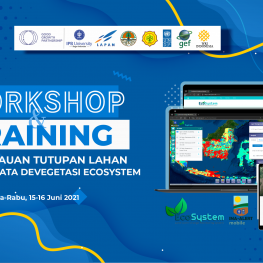
Zoom Meeting View mapLand cover monitoring in the “Land Use Change Monitoring Tool to Ensure Responsible Land-Use Arrangement for Sustainable Development” system which was developed during 2018 – 2020 has resulted in predictions of changes in land cover or vegetation and land cover predictions for agricultural commodities. Products are displayed and can be analyzed via the WebGIS EcoSystem. WebGIS provides easy access and displays tabular and spatial data online. The system is supported by the INA-Alert android-based application which helps validate and verify the data displayed by WebGIS. The existence of WebGIS and applications in one platform is expected to assist stakeholders in the planning and control of agriculture, forestry, and other land cover sectors at the central and local government levels.
Changes in the land cover of vegetation have also been shown in the National Forest Monitoring System (SIMONTANA). Every 8-day period, the location of the vegetation data can be shown (distribution throughout Indonesia). Each data contains information on the confidence level and validation status. The existence of data is needed to ensure the occurrence of land cover changes that occur in the field.
The prediction of land cover for plantation commodities in the WebGIS EcoSystem can be displayed tabularly and spatially based on the administration of the province, district, sub-district, and village. The resulting land cover data is based on machine learning prediction modeling. Updating the modeling sample data resulted in a mapping of plantation commodities with higher accuracy. The resulting prediction data helps in planning the sustainable development of plantation commodities.
Currently, system development involves stakeholders at the central level, namely the Ministry of Environment and Forestry, and the Ministry of Agriculture. Meanwhile, at the regional level (provincial and district) it comes from the environmental service and the agricultural sector in general. The involvement of the parties plays a role in improving the quality of the resulting system data and developing the system in a sustainable manner. Therefore, it is necessary to share experiences and knowledge in using EcoSystem and Ina-Alert products from ministries and agencies to inventory the needs and quality of data needed for planning, monitoring, and controlling land cover in the agricultural, forestry, and other land cover sectors. Specifically, the specific objectives of the activity are:
- Delivering published developments on vegetation data and its platform
- Delivering analysis of vegetation data and commodity land cover predictions and their interpretation


